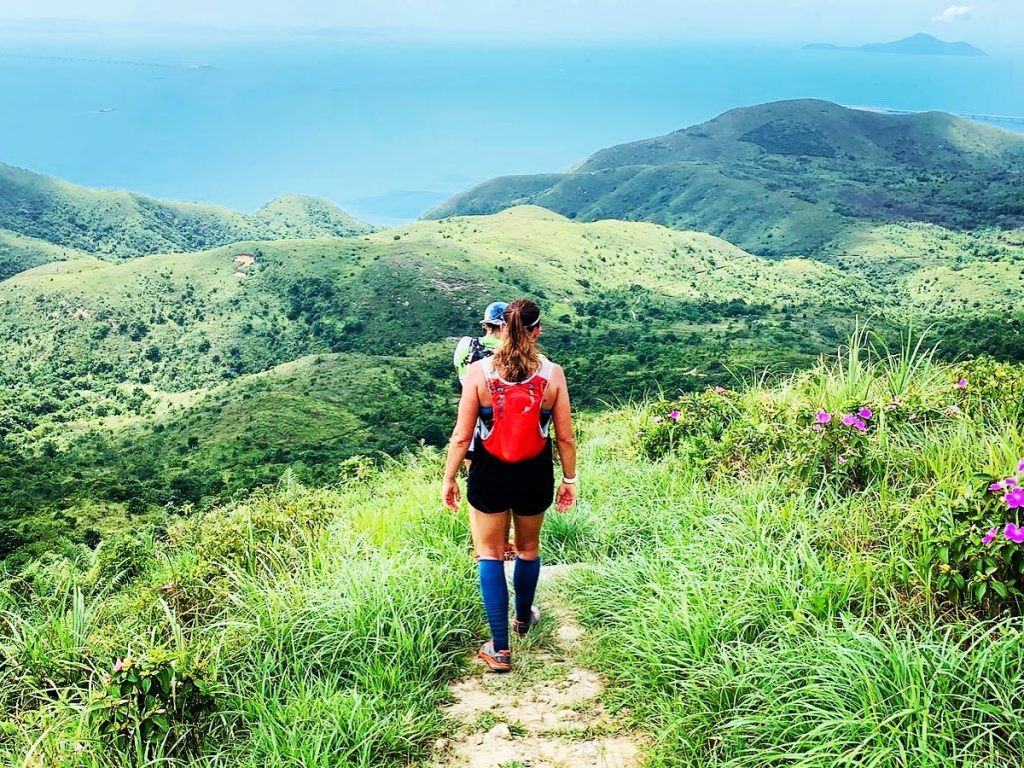
It’s been almost a year since I ran my first 50km race (Surf Coast Century in Australia with Jessica Short), which was a beautiful and brutal experience. I remember very vividly the excitement, atmosphere and the feeling of crossing the finish line.
The UTMB Virtual 50km in Hong Kong would be very different. It would be solo. It would be more elevation. There would be no aid stations. No finish line. No twin sister. It would also be 30 degrees and 85% humidity.
For most parts, it would be hell…
4am: I was up for mobility and coffee with Jess in Australia (and our new rescue pup Zeus, who enjoyed the downward dog on my yoga mat )
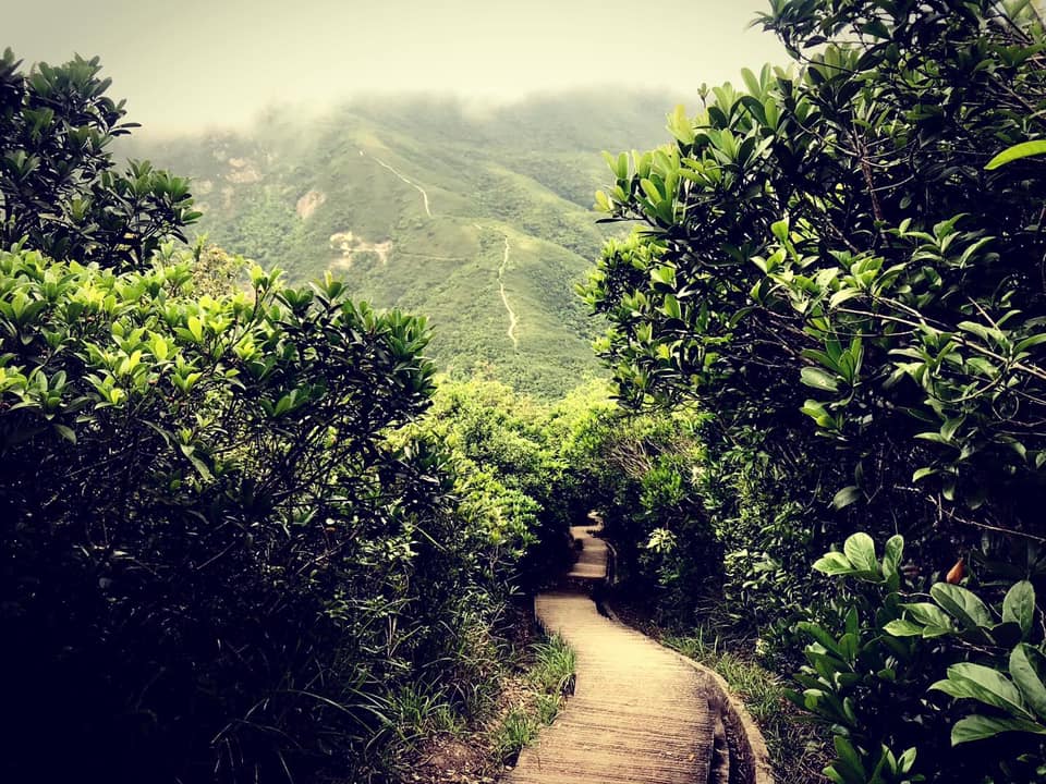
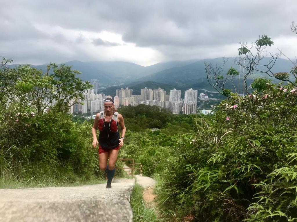
5am: I started the run with 15km on Hong Kong’s waterfront which was amazing. Cool, quiet and flat, with the sun and city rising around me. My legs felt good and I felt ready for what was ahead (spoiler alert: I wasn’t)
Feeling ready on the waterfront
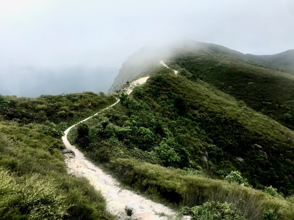
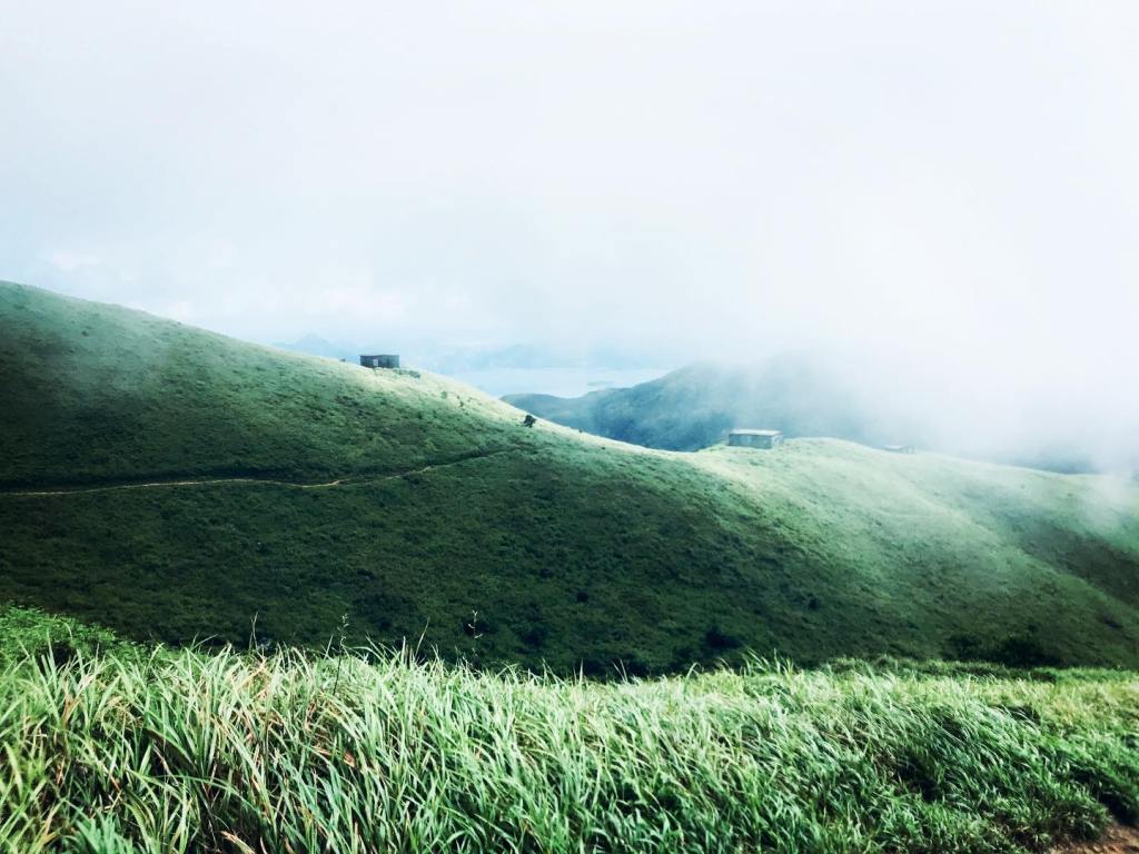
15km: I made a quick pit stop at home to change my shoes and refill water, before heading up to the Bowen Road and then Parkview. The next 15km felt pretty dreamy. I had the trails to myself and most importantly, someone had run before me and cleared the way of spiders. Yey. Even Violet hill didn’t feel as violent as it usually does.
Feeling less ready on Violet Hill.
30km: I hit The Twins, twice. And this is really where things started to fall apart. I’d been making pretty good progress on the kms until that point. But the Twins made me think that my Garmin was broken, because the kms stopped moving (I don’t know why this was such a surprise: I’ve done the twins so many times before). I lay on the floor at the top of Twin 1 in a metaphorical pain cave.
32km: I made a pit stop at Repulse Bay and picked up 2litres of water and four bottles of Lucozade.
32.2km: I vomited Lucozade
33km: Back at Tze Kong Bridge I took the single trail towards Tai Tam Reservoir, which is one of my favourite, before hitting the steep concrete incline towards Quarry Pass. Up and up and up and up. And very little shade. The sun was fully out, and the humidity was high
40km / 1,500m+: my Garmin started blinking low battery so I knew I had to crack on and get this done, or the race wouldn’t register. So, I altered the last 10km of the course to do hill repeats on Mount Parker. Hill repeats. After 40km. Talk about pain cave. And existential crisis. And self-yodelling.
45km / 2,000m+: My Garmin was still blinking at me. The hill repeats hurt. I had to lie down in the shade every couple of kms. But I was close.
48km / 2,300m+: Garmin on 5% battery. I was at the top of Mount Parker and just started running in 50m loops. It rained, I think. I’m pretty sure I was swearing the whole way. Lucy and Jess were the steady voices in my head (aka on whatsapp) telling me to just keep going. Because I honestly thought about stopping. At 48km.
50km / 2,500m+: I’m pretty sure I burst into tears and then realised that a guy had been watching my entire 2km mania . It hurt all over. I had to lie down. I couldn’t speak on the phone.
Done.
50km: I was at the top of a mountain. In a place where taxis couldn’t reach me. I had to walk 5km back down. Farmers shuffle. Pain cave.
5pm: Epsom salt bath. Burgers. Restless legs but a dawning sense of achievement (somewhere in the fog). I had finished.
UTMB Race results: 3rd in category, 7th female overall, 59th (out of 3,501).
Running Hong Kong’s big four trails has been a goal of mine for a while now, so I’ve loved having the opportunity to explore them over the last couple of months. An adventure of epic proportions… but not without a few hiccups (boars, monkeys, snakes, stupidity, humidity, dehydration, more stupidity that led to more dehydration etc). Even in 80-90% humidity, it was the most fun ever.
Here’s the breakdown:
Wilson Trail (78km, 3,800m elevation, South to North)
Maclehose Trail (100km, 4,500m elevation, East to West)
Hong Kong Trail (50km, 1,200m elevation, top to bottom)
Lantau Trail (70km, 3,700m elevation, loop on Lantau island)
Wilson (78km, 3,800m elevation, from South to North)
Sections 1 + 2 (11km)
Because The Twins 👯♀️ are the beasts of the first section, you kind of forget that there’s another (bigger) hill after them, right up until it’s towering over you at Tze Kong Bridge. But it’s not as bad. And once you get to Parkview you know you’re half-way. And hopefully the shaking in your thighs will get better, right?
The Twins
Jardine’s Lookout is a more gradual incline with amazing views of the city, until you turn left onto Braemar Hill Peak and then your knees really do start trembling (physically and emotionally). Just focus on the views, because they really just get better and better. The descent to Mount Parker Road is pretty straight forward (for people with fully functioning knees, not me) and then you turn right into The Tree Walk which, despite my reservations, is a fun single trail.
The trail spits you out somewhere random in Taikoo and you have to keep running until you get to the MTR, because otherwise you haven’t really done the whole trail, have you? Cold drinks and snacks at Circle K have never tasted so good.
Sections 3 + 4 (17km)
It was only a matter of time before I fell on my backside on this adventure, and this was the day for it. It was also a day for testing my navigation skills because I struggled to find the beginning of the Wilson 3. Luckily for me, Yau Tong’s shouty village dogs kept me on the straight and narrow by barking every time I went wrong. Fear is a great incentive to navigate, it turns out.
The first part of the trail is also a fitness trail with amazing views back across Hong Kong Island, and a Tai Chi fitness group rocking out to hip hop.
It got hotter and higher as I went up Devil’s Peak – beautiful views and lots of steps, and then colder and lower during the descent until it was really just a tiny road… which got so narrow and obscure that I had to stop to consult the map (aka become easy prey for mosquitos).
After a few wrong turns and a lot of greenhouses, I reached Section 4, which throws you straight into a wonderful kind of jungle. It’s as far away from Hong Kong’s cityscape as you can imagine 😍. There are also a lot tree trunks, which are snakes until proven otherwise, in my opinion.
A light rain made everything slippery, which I learnt the hard way – losing focus for a moment only to find myself in a heap on the rocks. Elbows and knees everywhere. Even though I hadn’t seen another person in ages, I still looked around to see if anyone had seen me 😂
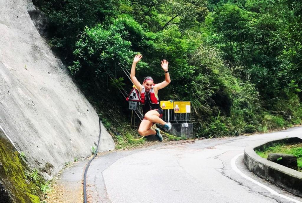
The massive ascent up towards Tates Cairn is supposed to be rewarded with amazing views of Hebe Haven and then Kowloon, but the rolling fog had become so bad that I could barely see my own feet. So, to keep myself entertained on the concrete descent to Shatin Pass, I took a jumping selfie (as you do), just as an entire family turned the corner to watch me.
A classic jumping photo, with a full audience.
By the end of the trail, my entire right leg (hip, hamstring, knee, ankle) was calling for an Epsom bath. And I was starving. But it’s okay to eat lunch in the bath, right?
Sections 5 + 6 (13km)
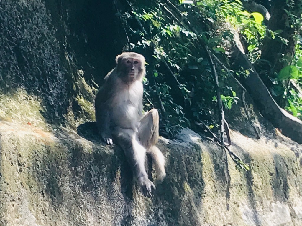
I was ready for the snakes (football socks pulled to knees) and spiders (stick in hand), but not for monkeys. Never for the monkeys.
And in my defence, they lured me into a false sense of security for the first 5km. They were quite cute and mostly ignored me. And the trail itself was wonderful – a massive catchwater through Lion Rock Country Park.
Good monkey.
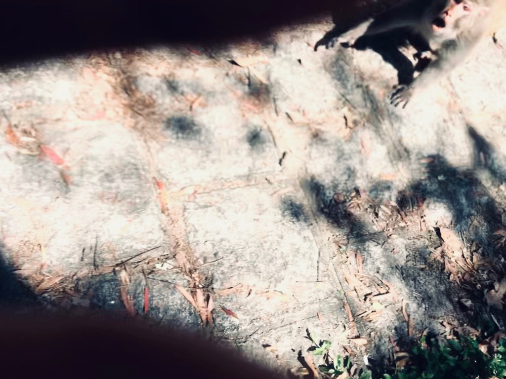
Bad monkey (top right hand corner)
But when I got to section 6, things got bad. I could see a gang of about twenty monkeys in the distance in some kind of feeding frenzy. I attempted to walk through the group but had to turn back when a couple of big ones bared their teeth at me (see photo above). I tried to remember some basic rules of survival: do not run, do not look scared etc etc. But these MFs were pretty scary and I really wanted to leg it.
There was no way around them if I wanted to continue the trail, so my only option was to go through the monkey gauntlet or give up completely. And then a bus arrived on the road next to me as if to say, here you go. Just give up. But that wasn’t the plan. A kind man got off and offered to walk through the monkeys with me. Yes, you read that right.
He was cool as a cucumber, even when a monkey hissed from the floor and then darted to a branch overhead to hiss closer to our faces (I’m not even going to describe the noise I made as I grabbed the kind stranger’s shoulders and marched him through the rest of the monkeys). I couldn’t thank him enough, but I think he found the whole thing amusing.
For the next few kms I was questioning my decision to carry on. The monkeys were still everywhere, albeit mostly ignoring me again. But the fear was still there. Until I passed a friendly group of hikers, one of whom yelled that I looked like Wonder Woman. That made me smile, even though I’m pretty sure I looked like a hot mess. But Wonder Woman can fight off monkeys, right?
I was super glad that I’d decided to continue because the rest of the trail was stunning 😍. I took a wrong turn down a very big hill which took me a while to forgive myself for, but we’ll just call that part of the adventure.
At last, Shing Mun reservoir came into sight, my departure point from the trail. For now. Back home to Epsom salt, heaps of water (I ran out at 12km) and an amazing amount of calories.
Sections 7 + 8 + 9 + 10 (37km)
I wasn’t really planning on doing a marathon over a mountain range, but that’s just kind of how this part of the trail went. It started back at Shing Mun reservoir on a beautiful single trail next to the water. Breath-taking. And the best part? Not a monkey in sight.
There was quite a bit of concrete after the reservoir and then a lot of navigating through Yuen Tun Ha village to get to section 8, which is where the real work starts. Up and up and up. The reward is stunning – Plover Cove on one side and Shenzhen on the other – views for miles and miles. That is, until you get so high you’re in the clouds.
Up and up and up.
Section 8 finishes at Cloudy Hill, which I thought might be a cute little village with a snack shop and a road with a taxi… but which is in fact, just a cloudy hill. In the middle of nowhere.
Faced with the decision to try to leave the trail here (20km in) or just carry on (16km to go), I made the questionable decision to keep going. My legs felt good. I had enough food. What could go wrong, right?
Well. I perhaps didn’t quite grasp the magnitude of the mountain range ahead. Not just one mountain, but several. A total of 1,700m elevation. Oh, and I ran out of water with three hours to go until the end. Yikes.
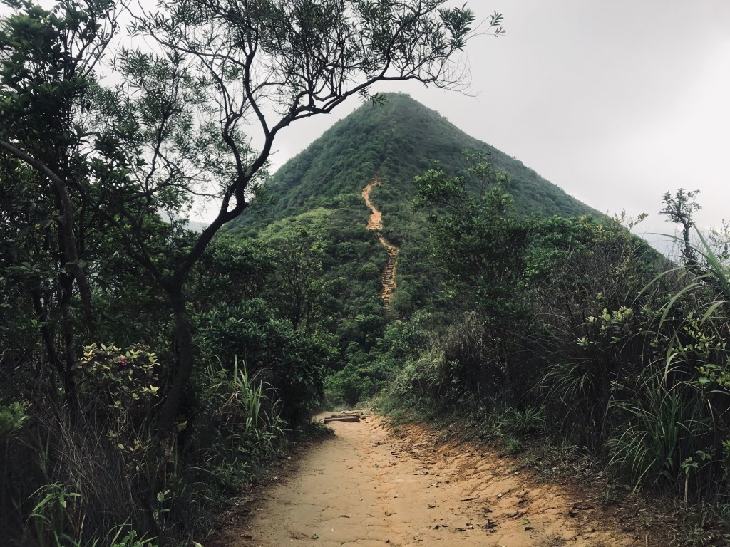
But. It was stunning. The clouds rolled over the hills (and me) as I went, shifting the views with it. My legs held on, even if a bit of dehydration kicked in. The series of peaks make you feel like you’re running on the edge of the earth – it’s definitely one of the most stunning trails in Hong Kong.
On the edge of the earth (Pat Sin Leng)
At last, I hit the final peak of the range and began the descent down. And thankfully I was so delirious from the exertion that I didn’t even flinch when a bamboo viper snake (highly venomous) wriggled on the path next to me – I just kept going.
The last few kilometres were a rather ungraceful farmers shuffle with a lot of self-talk and checking maps (how much further?!). When I finally reached Nam Chung, I found a vending machine and emptied out all the sports drinks 😂
And when I finally got home, I sank into an Epsom salt bath that was as much salt as it was water, and sat there for ages.
Best bits: Sections 9 + 10: Pat Sin Leng mountain range. Despite the elevation and complete lack of water, this is beautiful.
Not my favourite: Section 5: Did I mention the monkeys?
——-
Maclehose Trail (100km, 4,500m elevation, from East to West)
Section 1 + 2 (24km)
With weather like we’d been having in HK, it was only a matter of time before I got steamrolled by a thunderstorm. This was the trail for it.
The morning sun over High Land Reservoir was an immense experience – the water was so still that it looked like a mirror. In fact, everything was still. Apart from the cicadas, which were so loud that it felt like being electrocuted.
Section One
Most of Mac’s Section One is on concrete roads, which can be hard on the knees, but the views make up for it. Also, it’s a slalom of cow poo (and sometimes cows) so you have to pay attention to where you’re putting your feet.
Then you hit the coast and it’s a sea views for miles and miles… and also steps for miles and miles. There’s a bit of relief when you descend to Long Ke Wan and then Sai Wan, where you can drink your body weight in cold drinks (which I did, because I’d lost my body weight in sweat).
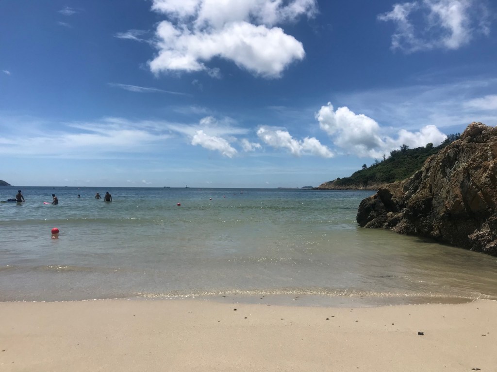
And then when you hit Ham Tin beach you really are in heaven. White sand and clear water. Breaking waves and blue skies. And not a soul in sight 😍
Ham Tin beach
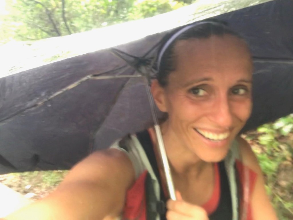
As I ran the rest of Section 2 through the jungle-like trail (neon fiddler crabs on the floor and frog noises coming from the wetlands), I started to feel the closeness of a changing weather system. And before I could do anything about it, I was suddenly running through sheets of torrential rain. And then before anyone else around me knew it, I was trail running with an umbrella. A classic look.
Nailed the look.
The last few kms to Pak Tam Au felt longer than they were. Probably a combination of subtle gradient and not-so-subtle torrential rain. But it was pretty wonderful to suddenly find myself on the road and in a cab and then in an Epsom salt bath and then eating Thai for lunch, because I needed to replenish 2000 calories.
Sections 3 + 4 + 5 (34km)
“Fear doesn’t exist anywhere except in the mind”.
And that’s exactly where it took refuge during Section 3.
Which is a real shame because I finally felt like I’d got everything else right: extra water and salts, sweet potato wedges in a bag (which turned into mash, of course), neon snake-protecting socks and a giant sense of adventure.
But I started Section 3 with quite a bit of doubt in my mind, not helped by the super claustrophobic fog and the solitude of a jungle ascent.
The reward at the summit was supposed to be amazing views, but the fog was too close. Instead, I came face to face with a large black shape in the path ahead, which made my heart stop. Definitely mammal, but not human. Ah yes, the cows were back. And they refused to budge so I had to tip toe around them on the trail. If you’ve ever been warned not to walk behind an animal with hooves, this really isn’t for you.
Not quite what I was expecting to run into (literally).
The jungle got denser and my sense of existential despair got worse, and then I reached a plateau at Cheung Sheung. Which was harmless but had all the makings of a low budget horror film (abandoned buildings, thick jungle, blinding fog, and me). The fog was closing in. The Fear was closing in.
And I didn’t know which way to go, which was the worst part because I was about to charge into a dead-end trail in thick jungle, armed with a stick to ward off the spiders. Surely this couldn’t be right?
And then I heard a noise from behind me. Voices. People.
Hope.
I followed them onto the right trail, at last. And then I was so happy to be going the right way and out of the jungle, that I didn’t mind running through sheets of spiderwebs. Kind of.
I was soon distracted from The Fear by exertion as I started the ascent at Section 4 to Ma On Shan (700m), and then stayed along the mountain ridge for the next few kms. The fog returned but it felt lighter, more open.
Section 4 takes you through many different types of trail, which is wonderful. Birdsong, cicadas, crabs, more cows, more spiders. And then it abandons you in the middle of nowhere without a hope of getting a taxi. So, I carried on through Section 5 until I reached Lion’s Rock. And then was very glad to get in an air-conditioned taxi.
Sections 6-10 (37km)
“When you’re going through hell, keep going”.
And to be fair, it wasn’t hell until the last 7km, which was really when everything fell apart.
Needle Hill
The best part of Maclehose Section 7 is Needle Hill, where you’re rewarded for climbing 532m of stony staircase with sweeping views of Sha Tin and Lions Rock. After that, it’s pretty heavy going on a concrete service road, with a subtle gradient that makes you work a little bit harder than you think you are. And then a massive gradient that makes you want to cry 😂
At last you reach the start of Tai Mo Shan, Hong King’s largest peak (957m). It’s not as bad as it sounds and feels a bit like rambling in welsh countryside – rolling green hills, a nice cool breeze in the clouds… and lots of cow poo. The views from the top are epic, and definitely deserve a selfie or two.
Hong Kong’s highest peak (957m)
The descent down is a series of concrete hairpin bends, which can make you feel dizzy after a while. But it’s a nice way to descend from the clouds. Also, you’re now so far north that your phone tries to switch to data roaming in Mainland China.
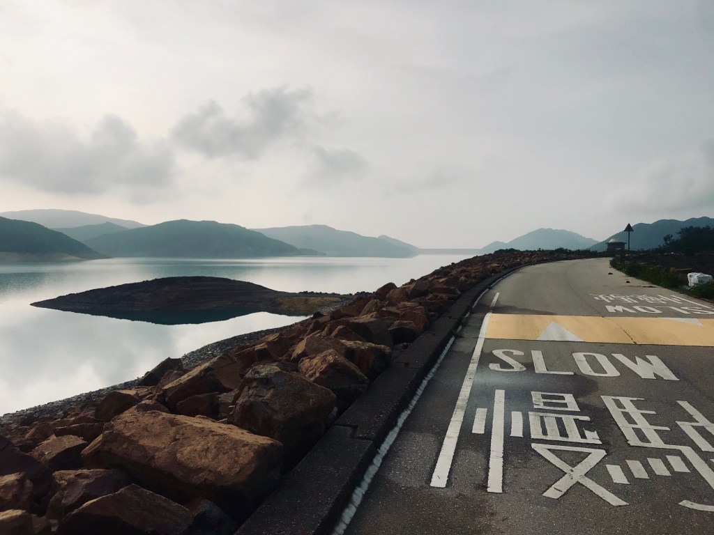
Section 9 and 10 take you through Tai Lam Country Park and is A LOT of paved concrete running. But the views of the reservoir are stunning 😍.
At 30km my Garmin died. And I think that’s where everything else started to die. Hope, for instance. And muscle elasticity.
And then the sun came out, which on an unshaded stretch of concrete catch water, proved pretty lethal. It was hell.
Quick lie down.
Luckily, there were multiple BBQ sites along the way, which provided much needed shade and an opportunity to lie down every so often… regardless of the families that were picnicking around me.
With 3km to go I ran out of water, which in itself wasn’t too bad because there’s only 3km to go, right? Except as soon as I ran out, all I wanted was water. And for the second time in a month, I wondered how bad drinking a puddle could really be (spoiler alert: pretty f-ing bad).
In dire straits, I rang Jess for moral support and she gave me a pep talk that was a bit like the scene in Airplane! where the Air Traffic Control talks Ted Striker through landing a plane full of passengers, even though it’s falling apart.
Me: “I’ve run out of water”
Jess: “You’re doing really well, keep going”
Me: “My Garmin died so this part doesn’t even exist”
Jess: “You don’t need Garmin, just get to the finish”
Me: “ITBs are finished”
Jess: “You can crawl if you have to”
And so on…
The last 500m takes you through a residential area and spits you out on a massive main road. There’s a sign to mark your achievement (I celebrated by practicing my yoga Corpse Pose) but you have to walk even further to get to a taxi or a drink, which might have been the slowest steps I’ve ever taken.
An air-conditioned seat on the MTR was a real treat, but probably not for anyone sitting anywhere near me. Sorry.
Best bits: Sections 1 + 2: A coastal run that goes straight over Tai Long Wan, one of the most beautiful beaches in Hong Kong.
Worst bits: Section 10: A catch water that goes on forever. And normal people having picnics while you hallucinate about Gatorade. Also, the puddles start to look drinkable.
——-
Hong Kong Trail (50km, 1,200m elevation, top of HK island to the bottom)
Sections 1 + 2 + 3 + 4 (25.5km)
I’d had a mildly terrifying animal encounter on every single one of the big four trails and the HK Trail was no different.
For the first few kms I was pretty much running around the side of Victoria Peak, so the views were incredible and constantly changing 😍
A couple of country parks later, I was on single track in Aberdeen which was beautiful. The embankment to my left was about head height and the trail dropped off to my right into masses of woods.
I think my peripheral vision had been used up trying to avoid spider webs, so when something started running on the embankment next to my head, I freaked out a little.
And then when the entire embankment of shrubbery started moving, I freaked out a lot. It took me a few seconds to work out what it was, but the grunting gave it away. Wild boars. A massive family of them (it felt like 10,000, but was probably more like 7-8).
And then suddenly they were dropping down from the embankment onto the trail around me, before charging into the jungle.
It was a bit like if Disney made horror films.
And then the strangest part of all. There was a half-naked man in the shrubbery following them.
I ran a bit faster after that 😂
Outrunning a few wild boars.
The rest of Section 4 was a mixture of single trail and paved path. And sunshine. Lots of that too. And no more boars or naked men, which was pretty nice too.
Sections 5 + 6 + 7 + 8 (24.5km)
Section 5 takes you to the top of Mount Butler (456m) and then descends via Jacob’s Ladder (steep steps that feel very much like going down a ladder facing forwards) and tarmac road into Tai Tam. There’s a sharp turn left that takes you through a wonderful single trail until you reach a road, where you take your life in your hands trying to dodge double decker buses veering around the corner.
Yellow orbs.
Section 7 was my least favourite – it’s basically a gauntlet of spider webs along a narrow catch water. The only redeeming feature is the secluded beach you can detour to right at the end, which is quite nice for potato and egg snacks in the sunshine.
Dragon’s Back
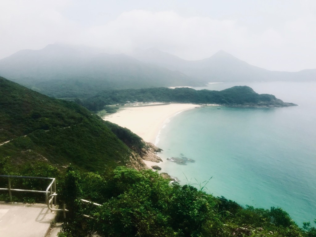
It’s good time to get some carbs into your body because section 8 begins with a steep incline until you reach Dragon’s Back, which is one of Hong Kong’s most famous trails. And you can see why. The views either side of the ridge are breath-taking – ocean and islands for miles and miles. And at some point, you spot Big Wave Bay, the end destination, which promises cold drinks (x5,000) and a dip in the sea.
The final section is just stunning and worth doing on its own, again and again. And then comes the beach.
I think I pretty much changed into my bikini while I was sprinting across the beach, and then walked face first into the sea.
Big Wave Bay
Best bits: Section 8: Hong Kong’s famous Dragon’s Back, followed by a dip at Big Wave Bay beach.
Not my favourite: Section 7: Do you like eating spiders? You might enjoy this catch water.
——-
Lantau Trail (70km, 3,700m elevation, circular loop on Lantau island)
Sections 1+ 2 + 3 + 4 + 5 + 6 (25km)
I was lucky enough to be joined by a couple of friends for the Lantau Trail, which made the adventure even more fun. And we entered our respective pain caves at different times, so we were able to help each other through… mostly with the promise of cold beers at the end.
The first part of the Lantau Trail is all elevation. Just when you think you’re at the top, you see the next peak. The bigger peak. But it’s amazing.
Sunset Peak
The incredible views took my mind off the fact that my thighs were burning. The ascent up Sunset Peak (869m) was gradual and littered with stone huts that made for nice wind-breakers when the clouds rolled over the ridge.
Lantau Peak (934m) literally loomed in the distance and promised even more thigh-busting-ness. The ascent into the clouds meant that the views disappeared and there was definitely nothing to break the wind, which made me want to crawl on hands and knees at some points 😂
Lantau Peak
The descent down was steep and endless, but the view of the Big Buddha and ocean beyond is worth it. And the knowledge that we’d be able to get our hands on some overpriced cold drinks at one of the souvenir shops at Ngong Ping.
We sat down with cold drinks and watched an elderly man take a selfie with a cow.
Undulating elevation.
Sections 5 and 6 were a huge surprise, both in terms of how beautiful they are and also how much elevation there is… because we kind of assumed that Lantau Peak would be ALL the elevation. The undulating hills (and views) are stunning, but they seem to go on forever, especially when you can see Tai O in the distance (our destination) which didn’t seem to get any closer. We took it in turns to hit our pains caves and had a merry old time trying to cool down in cold springs along the way.
The final descent to Tai O is pretty brutal – a lot of downhill concrete and the threat of yellow orb spiders in your face to keep you on your toes. But it’s worth it once you get there – we ran straight into an air-conditioned restaurant and ordered just about everything on the menu.
The icing on the cake was a sun-filled ferry back to Tung Chung, which was pretty dreamy, even if we did have to sit on the floor to make the throbbing in our legs subside.
Sections 7 + 8 + 9 + 10 (29km)
Rural villages and rice paddies
Section 7 is made up of a beautiful single track that takes you along the coastline and through rural villages and rice paddies. It kind of feels like you’re backpacking in South East Asia.
Section 8 is catchwater, which sucks, but as you carry on through 9 and 10, you can see Lantau Peak looming over you. And you feel very grateful to be running on the flat. We took a Diet Coke break at the end of section nine, which was wonderful. And then we stopped at Cheung Sha beach to have lunch, but it was closed due to Covid, so we jumped in a cab to Mui Wo and had a socially distanced lunch (and beer) there instead.
Sections 11 + 12 (14km)
We thought that the majority of this would be catch water, but we were pleasantly surprised to finish the concrete by the time we got to Pui O where we took a sharp right (missed it completely but found it eventually) onto the beach and then carried on around the coast until we found ourselves on a single track that took us inland.
On account of there being so many spider webs, we took in it turns to run at the front of the pack, which didn’t lessen the amount of screaming and laughing every time someone hit a spider web (or thought they’d hit one).
There’s a final ascent in section 12 but once you’re at the top, you know it’s basically a steeple chase down to the pub at Mui Wo for a well-deserved beer and bite to eat.
Best bits: Sections 2 – 7 are pretty epic, if you don’t mind not being able to feel your legs the next day
Not my favourite: Sections 8 and 10 are mostly catch water, which isn’t everyone’s cup of tea. But at least they’re too wide for spider webs.